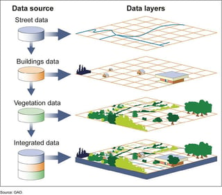
A geographic information system consists of integrated computer hardware and software that store, manage, analyze, edit, output, and visualize geographic data. From Wikipedia
The experimental system delivers near-real-time, street-level flood visuals to aid forecasting as well as emergency response.