
Overview
- Coverage doubled from last year, extending service to Hawaii, the West Coast, parts of south-central Alaska (Cook Inlet, Kenai Peninsula, Copper River, Prince William Sound), the Southwest, Great Plains, Great Lakes, and the interior Southeast.
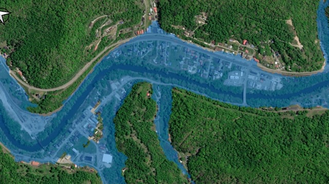
- Maps are accessible via the National Water Prediction Service and GIS applications, providing neighborhood-scale depictions that update in near real time.
- The suite includes hourly inundation analyses, five-day forecasts from the National Water Model and NWS River Forecast Centers, and static categorical FIM (CatFIM) maps.
- For Hawaii, Puerto Rico and the U.S. Virgin Islands, FIM employs a 48-hour National Water Model forecast designed for fast-response rivers.
- NOAA projects full nationwide availability in 2026, targeting 110,000 river miles near RFC forecast points and more than 3.6 million river miles covered by the National Water Model.