
Overview
- Morning downpours taper to scattered showers before a cold front sparks another round of showers and a few storms from early afternoon into the evening.
- Forecasters place the region in a low, Level 1 severe risk with damaging wind gusts possible and a brief, isolated tornado not ruled out.
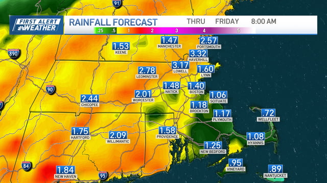
- Most spots pick up about 0.2–1.0 inches of rain with locally higher totals over 1 inch and isolated pockets near 2–3 inches, raising a localized flooding risk.
- The rainfall provides useful drought relief even if some improvements are not reflected in today’s US Drought Monitor update because of its reporting window.
- Cooler, less humid air builds in Friday into the weekend, as the tropics are monitored for next week with Tropical Storm Humberto staying offshore and a nearby disturbance likely to become Imelda still uncertain on U.S. impacts.