
Overview
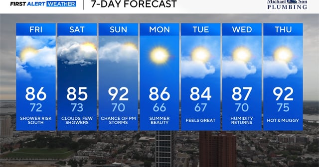
- A weak cold front arriving Friday will usher in clouds and stray showers that keep highs in the mid-80s through Saturday.
- Sunday’s temperatures will climb back into the lower 90s with heat index readings between 95° and 100° alongside a risk of isolated afternoon and evening storms.
- A stronger front is expected Monday to clear humidity and deliver partly sunny skies with daytime highs in the mid-80s and overnight lows near the mid-60s.
- The midweek period from Monday through Wednesday will feature low humidity and comfortable conditions under mostly sunny skies.
- Another influx of tropical air is forecast for late next week, driving heat index values above 100° and prompting scattered afternoon storms.