
Overview
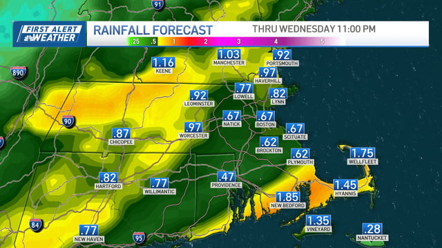
- Rain spreads in late Tuesday night and tapers Wednesday midday, with most spots picking up about 0.5–1.0 inches and locally higher totals in western and mountain areas.
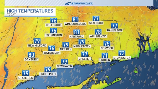
- A sharp temperature drop follows the front, with highs falling into the 50s and 60s by Thursday and a credible inland frost or freeze risk by Friday morning.
- Commuters should expect slick roads and reduced visibility during the first widespread rain after a dry stretch, with isolated non-severe thunderstorms possible in some areas.
- King tides driven by the Harvest Supermoon are expected Wednesday through Saturday, bringing minor flooding to typical low-lying coastal locations.
- Forecasters are tracking an Atlantic tropical wave likely to organize into a named storm that current models curve out to sea, with an uncertain chance of a coastal low bringing showers late weekend into early next week.