

Overview
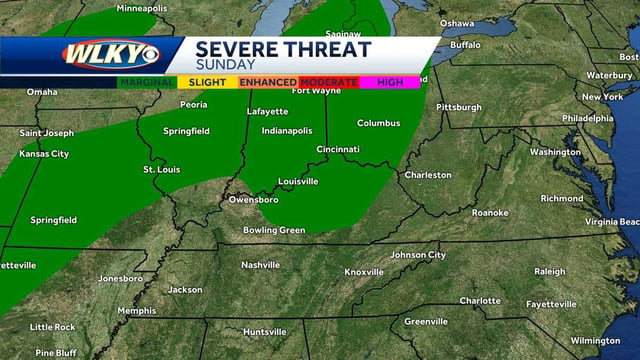
- Sunday features mostly dry conditions with isolated showers and a low-end risk for gusty storms in some areas, including a Marginal Risk outlined for Metro Detroit.
- Heat and humidity build Monday into Tuesday before a cold front arrives, pushing highs back toward seasonable levels by midweek.
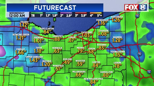
- The front brings scattered showers and thunderstorms Tuesday into Wednesday, with heavy downpours and gusty winds possible but widespread severe weather unlikely.
- Drought persists in parts of New England, Ohio and Michigan, and forecast totals near 0.5 to 1.5 inches in spots like Northeast Ohio could help even as coverage remains uneven.
- Colorado faces the sharpest change, with a strong front dropping plains highs to the 60s and producing mountain snow around 10,000 feet Monday night into Tuesday.