


Overview
- The Storm Prediction Center highlights a level 2 risk Tuesday evening and overnight for eastern Nebraska and western Iowa, with hail and damaging winds possible.
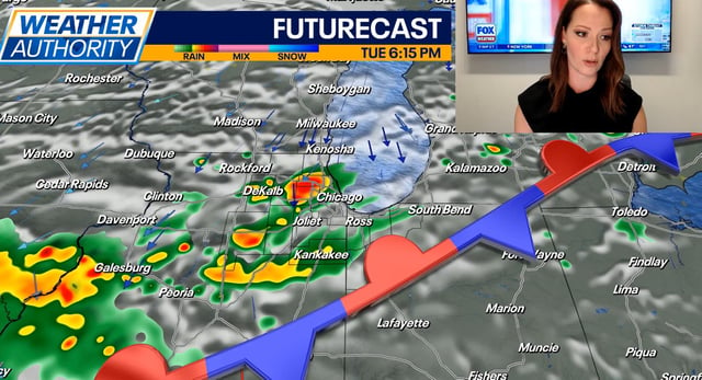
- A frontal system spreads showers and a few thunderstorms from Tuesday into Wednesday, with steadier rain likely Wednesday in parts of the Northeast and New England.
- Maine and surrounding areas anticipate helpful but modest rainfall, which forecasters say will not end ongoing drought conditions.
- Northern California remains very hot Tuesday with some Central Valley cities near 100 degrees, then cools mid to late week as a cut-off low lingers and introduces uncertain shower chances.
- Major Hurricane Gabrielle remains a powerful storm over the Atlantic and is turning away from Bermuda, with no direct U.S. impacts expected.