


Overview
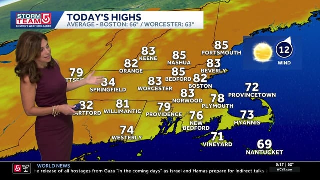
- Temperatures surged into the low to mid 80s Monday in many areas, with records set in parts of New England, as clouds begin to increase ahead of the change.
- A cold front is slated to move through Tuesday night into Wednesday in the East, already sliding through parts of the Midwest, bringing showers, breezy conditions and a wet Wednesday morning commute in spots.
- Most outlooks point to a few tenths to around a half-inch of rain on average, with isolated bands near or above 1 inch that would offer only limited drought relief.
- Cooler, drier air follows the front with highs in the 50s and 60s, gusty northwest winds, and a risk of patchy frost later this week in colder inland locations.
- The National Hurricane Center is monitoring a broad low in the Atlantic with a 60–70% chance of development within seven days, which is being watched for potential longer-range influences.