

Overview
- An area of low pressure is expected to form near the northwestern Bahamas and South Florida by Saturday, with the National Hurricane Center assigning a low 10% formation chance over seven days as it moves across the peninsula into the Gulf.
- Central and coastal Florida face elevated rain coverage this weekend (up to 80–90% along parts of the east coast), and parts of coastal Georgia and North Florida could see locally more than 3 inches Sunday into Monday.
- Rough surf, hazardous rip currents and higher-than-normal tides may lead to minor coastal flooding along the Southeast shoreline this weekend as onshore winds strengthen.
- Much of the country turns unseasonably warm and dry through early next week, with highs reaching the low to mid 80s in the Northeast and Mid-Atlantic, near-record heat in parts of the Upper Midwest, and only isolated showers in the Rockies.
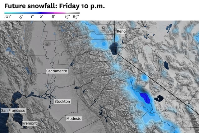
- A decaying front brings lingering clouds and spotty showers to parts of California before a dry, warmer weekend, while a midweek cold front elsewhere is forecast to return scattered showers and a cooler, more seasonable air mass; Imelda is now post-tropical with final NHC advisories issued.