
Overview
- High pressure continues to dominate early in the week, with highs commonly in the 70s to 80s and low humidity, plus patchy morning fog in some valleys.
- A weak low off the North Carolina coast is drifting north and will thicken clouds, with the best chances for showers Wednesday into Thursday along parts of the Mid-Atlantic and Northeast.
- Most precipitation is expected to be isolated or very light, with some areas seeing only sprinkles and many locations remaining dry.
- Easterly flow tied to the coastal system will knock some highs into the low 70s midweek before sunshine and warmer temperatures return late week, followed by a dry front and a modest weekend cooldown in some regions.
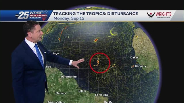
- Rain this week is not expected to ease ongoing dryness, and forecasters are also monitoring an Atlantic tropical wave for possible development without an immediate U.S. mainland threat.