


Overview
- The Met Office expects a warming trend under high pressure, with most places dry and Monday likely peaking near 24–26°C.
- Forecasters stress this does not meet UK heatwave criteria, despite sunnier skies and a warmer feel by the end of the long weekend.
- A few light showers remain possible, especially in western and southwestern areas on Monday, with regional highs for many towns mostly around 20–25°C.
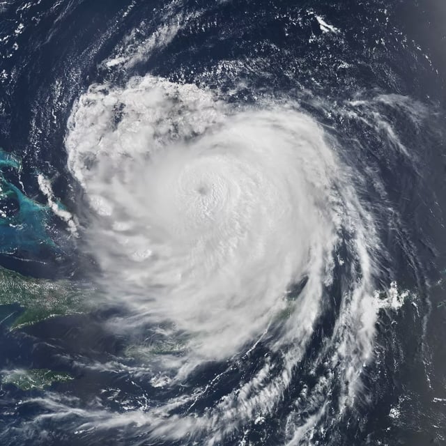
- Hurricane Erin is transitioning to an extratropical low, and its remnants could bring rain, gusty winds and large coastal swells from mid to late next week, though specifics remain uncertain.
- Met Office guidance contrasts with independent maps from WX Charts suggesting a brief spike to 30–31°C on 26 August in parts of England, a signal not endorsed by official forecasts.