
Overview
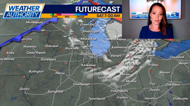
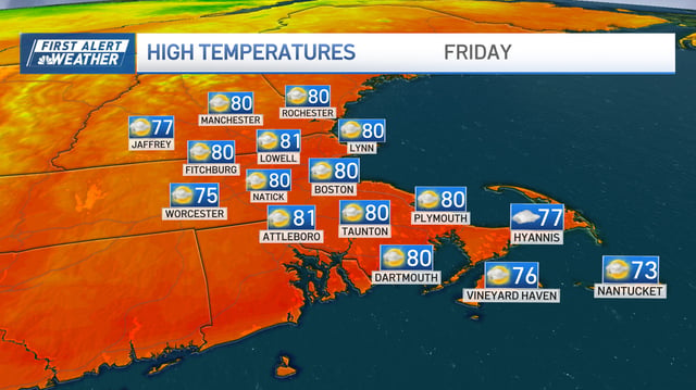
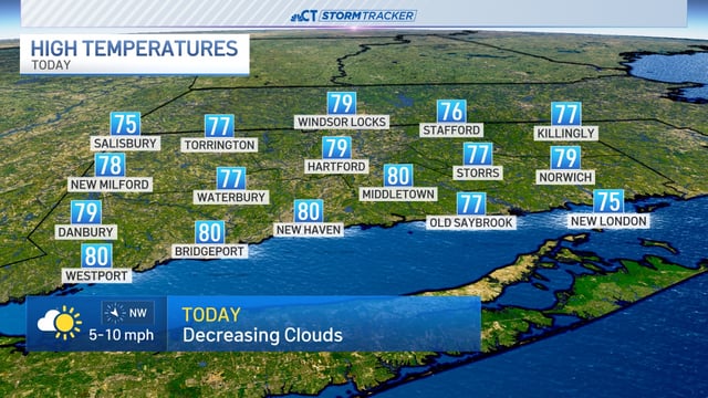
- High pressure expands, bringing sunshine, light winds and highs in the upper 70s to low 80s from the Twin Cities to Michigan, Ohio and Kentucky.
- Dense or patchy fog advisories were posted this morning in pockets, reducing visibility for some commutes before clearing.
- Baltimore–Washington forecasts call for showers and a risk of heavier downpours and thunderstorms Saturday afternoon and evening, with improvement Sunday.
- The National Hurricane Center and local teams are tracking Hurricane Humberto and Invest 94L, with possible indirect U.S. moisture or coastal effects early next week depending on their tracks.
- Forecast guidance points to a stronger Canadian high and cold front by mid to late week, bringing drier air and more fall-like temperatures.