


Overview
- Rain chances expand from Sunday into midweek across the Great Lakes, Ohio Valley and Northeast, with higher probabilities Sunday night into Monday in Northeast Ohio and Metro Detroit.
- Western Pennsylvania has declared Impact Days for Tuesday and Thursday as forecasters eye around an inch of beneficial rain with periods of steady showers.
- Central Indiana outlooks flag the potential for 1–2 inches in spots from slow-moving thunderstorms, though rainfall will be uneven across the region.
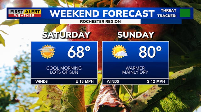
- Temperatures run unseasonably warm through the weekend before a front and cloud cover cool many areas back into the 70s by midweek.
- Regional risks include high fire danger and patchy frost in northern New England and a moderate rip‑current threat along South Florida’s Atlantic beaches, while Tropical Storm Gabrielle strengthens east of Bermuda with no U.S. land threat and only minor surf effects.