Overview
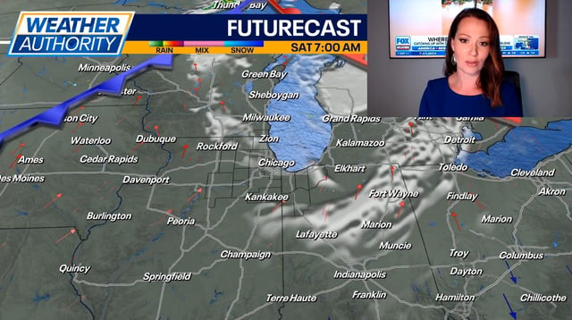
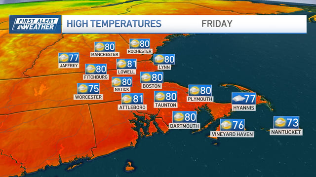
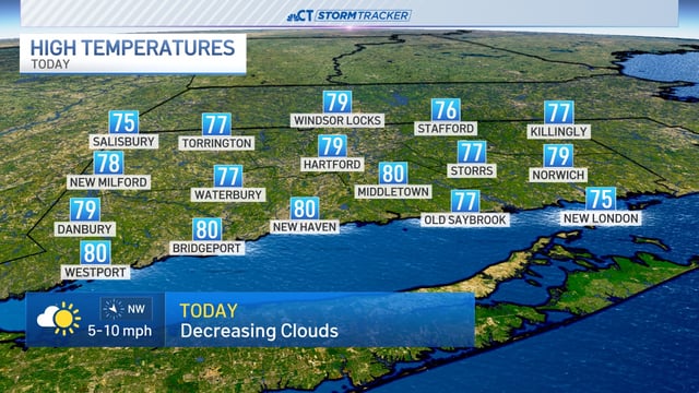
- High pressure and an upper-level warm dome are driving sunny, summer-like conditions for the Midwest, Great Lakes and Plains, with highs mostly in the mid-70s to mid-80s.
- Dense or patchy morning fog is reducing visibility for some commuters, with advisories posted in parts of Indiana, Kentucky and nearby areas.
- The Mid-Atlantic, including the D.C.–Baltimore corridor, is expected to turn wetter Saturday afternoon and evening with periods of rain, isolated thunderstorms and gusty winds.
- Isolated to scattered storms are possible in parts of the Mountain West and Desert Southwest, including Colorado and Las Vegas, while many urban areas remain dry.
- Hurricane Humberto and Invest 94L near the Bahamas may influence rain and coastal conditions early next week along the Southeast and Mid-Atlantic, though forecast impacts remain uncertain.