Overview
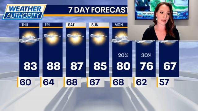
- High pressure keeps most areas sunny and unseasonably warm through the weekend, with widespread 70s to 80s and a few inland spots near 90 degrees.
- Southeast Wisconsin could approach daily records, with lakeside mid-80s and inland upper-80s Friday and Saturday.
- Clear nights continue to drop into the 30s to 50s in cooler regions, prompting frost advisories and occasional freeze warnings in higher terrain of the Northeast.
- Rain chances increase late Sunday into early next week as a front approaches and may stall, bringing scattered showers and dropping highs into the 60s where it passes.
- Marine hazards are in effect along parts of the Gulf Coast with a small craft advisory and localized coastal flooding risk, while Hurricane Imelda near Bermuda is being monitored.