Overview
- Dense fog advisories early Friday cut visibility to a quarter‑mile or less in spots from the Ohio Valley into parts of the Northeast, with conditions improving by mid‑morning.
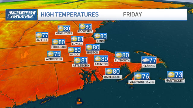
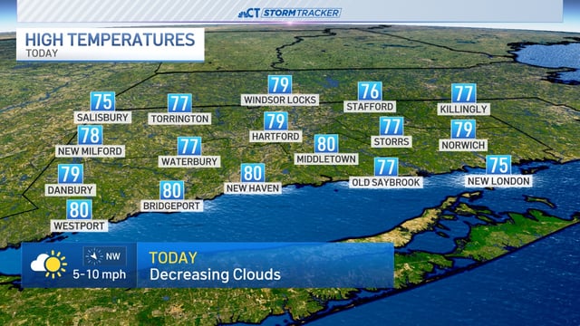
- A broad ridge and high pressure will keep most regions sunny and rain‑free this weekend, with highs widely in the 70s to low 80s and lower humidity.
- Maryland and the D.C. area are likely to turn cool and damp Saturday, with periods of rain by afternoon and evening before gradual improvement on Sunday.
- The National Hurricane Center gives Invest 94L near the Bahamas a high chance of development as Hurricane Humberto remains over the Atlantic, creating forecast uncertainty for early‑week rainfall and possible coastal effects.
- A stronger Canadian front is expected by midweek to drop temperatures and usher in a cooler, drier fall pattern across many areas.