
Overview
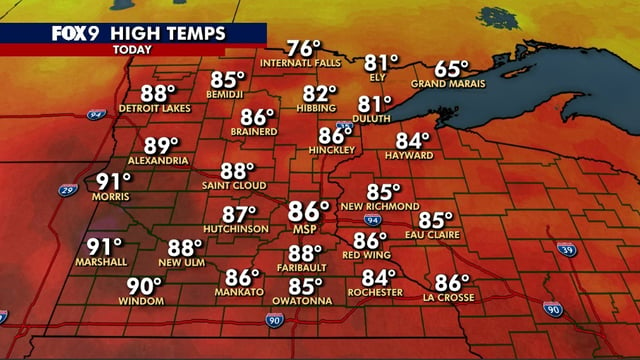
- Heat lingers today with highs reaching the upper 80s to near 90 in some areas after low 90s in spots yesterday.
- A more typical fall air mass arrives midweek, with highs dropping to the low 60s Wednesday and Thursday in New Hampshire.
- Overnight lows fall into the 30s to mid-40s for many locations, bringing a chance for patchy frost Thursday and Friday mornings.
- Dry weather is expected to persist through the weekend, with a brief warm-up possible and New Hampshire highs near 80 by late weekend.
- Precipitation outlooks diverge, with WMUR pointing to no rain until about Oct. 7–8, while another local forecast allows isolated pop-up showers midweek or Sunday.