
Overview
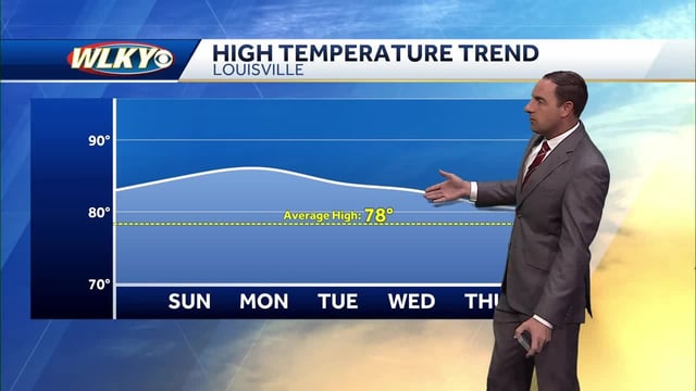
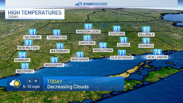
- Inland high pressure is delivering mostly sunny weather and unseasonable warmth into early week, with many areas near the upper 70s to low 80s.
- Tropical Depression Nine is expected to strengthen into Tropical Storm Imelda and could reach hurricane intensity as it lifts north near the Southeast coast.
- Latest NHC tracks keep Imelda’s center offshore, but forecasters caution that rain bands, coastal flooding, beach erosion and rip currents remain possible from Florida to the Outer Banks.
- Official alerts include Tropical Storm Warnings for parts of the Bahamas and a Tropical Storm Watch along Florida’s east coast from the Palm Beach/Martin County line to the Flagler/Volusia County line.
- Hurricane Humberto has rapidly intensified into a Category 5 storm and is forecast to stay over the open Atlantic, with swells potentially elevating surf and affecting Bermuda midweek.