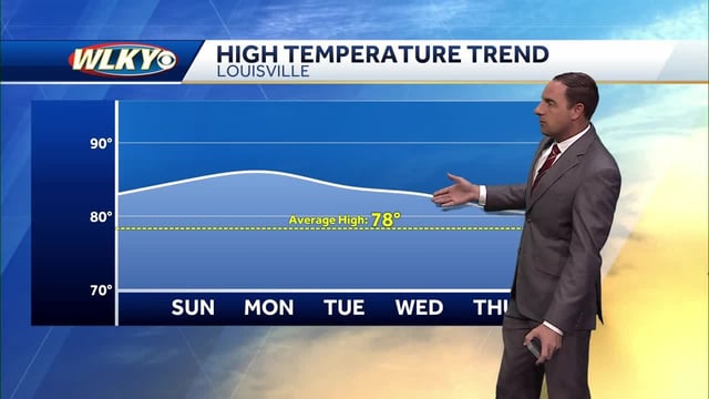
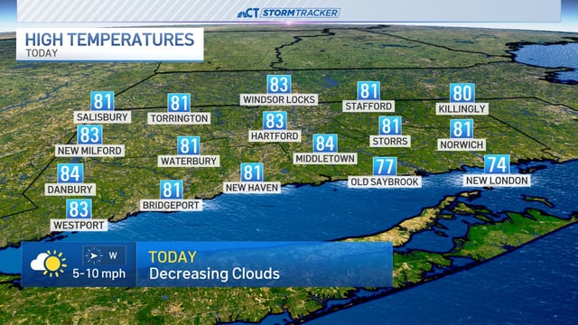

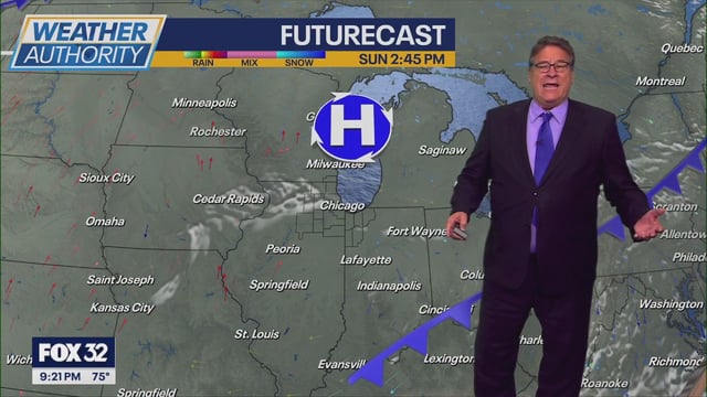
Overview
- High pressure keeps much of the country mainly rain‑free through Tuesday, with unseasonable warmth pushing many areas into the upper 70s and 80s.
- Hurricane Humberto remains a powerful storm well offshore, with swells likely to raise surf and rip‑current risk along parts of the East Coast.
- Tropical Depression Nine is expected to become Imelda as it lifts toward the Southeast coast early this week, though its exact track and intensity remain uncertain.
- The National Hurricane Center has Tropical Storm Warnings for parts of the Bahamas and a Tropical Storm Watch along Florida’s east coast, with potential for heavy rain bands, gusty squalls and dangerous surf from Florida to the Carolinas.
- A cold front Tuesday into Wednesday brings a noticeable cooldown for the Northeast and interior U.S., with some 30s–40s nights and patchy frost possible after a morning Dense Fog Advisory in parts of south‑central Pennsylvania.