Overview
- National Weather Service alerts include Freeze Watches/Warnings and Frost Advisories in upstate New York, with New England seeing highs in the 60s and lows in the 30s to low 40s and patchy frost Thursday and Friday mornings.
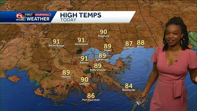
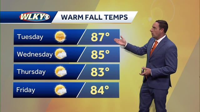
- An upper-level ridge keeps many regions unusually warm and mostly rain-free, with highs in the 80s to near 90 from the Upper Midwest to the Gulf Coast and breezy to windy conditions at times.
- The Twin Cities forecast calls for upper 80s to near 90 through Saturday with gusts around 25 mph Friday and a cooler turn early next week after limited storm chances late Sunday.
- Rain remains scarce for most areas through the weekend, with the next meaningful chances pushed to late weekend or early next week and likely to deliver uneven totals.
- Offshore Hurricanes Humberto and Imelda are staying out to sea yet impacting Bermuda and boosting surf and rip-current risks, while the Gulf Coast faces small-craft advisories and possible minor coastal flooding as onshore winds develop.