


Overview
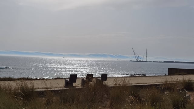
- Footage of the roll cloud, posted by X user Volcaholic, has amassed over 30,000 views and was officially verified by the Portuguese weather service IPMA through satellite imagery.
- Portugal recorded a new June high of 46.6 °C on June 30, intensifying unstable conditions along the northern and central coastline where the cloud was observed.
- Meteorologists attribute roll cloud formation to the collision of warm, dry inland air and cooler sea breezes, producing a low-level, tube-shaped arcus cloud that moves horizontally.
- The National Civil Protection Authority and IPMA have kept extreme heat and maximum rural fire risk alerts active through early July to prevent wildfires in vulnerable regions.
- Climate experts from institutions including Imperial College London say rising temperatures could drive more frequent and intense roll cloud events under ongoing climate change.