
Overview
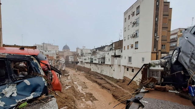
- The October 29 flood, triggered by torrential rain, caused the rambla de Chiva to overflow, with water depths reaching up to 4.5 meters in some areas.
- Chiva's narrow urban channels amplified the flood's destructive force, funneling water through constrained spaces and increasing pressure and depth.
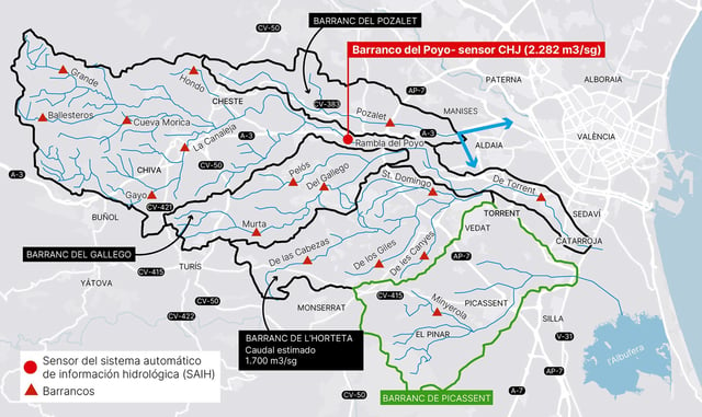
- The Institut Cartogràfic Valencià’s detailed flood maps reveal the inundation footprint and water heights across a 166 km² area, aiding ongoing risk assessments.
- Experts attribute the disaster to a combination of torrential rainfall and the Poyo basin's rapid hydrologic response, exacerbated by historical land-use changes.
- Proposed solutions include hydrological-forest restoration in the basin's headwaters and civil engineering works in densely urbanized zones to mitigate future risks.