


Overview
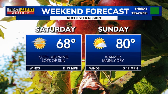
- Most regions remain warm and largely dry through Sunday, with only spotty or coastal showers and highs ranging from the upper 70s to near 90.
- Rain chances rise Monday into Tuesday across the Midwest, Mid-Atlantic, Southeast and Appalachians, with some forecasts highlighting Tuesday and Thursday as higher-impact periods.
- Slow-moving storms could drop 1–2 inches or more in spots, offering drought relief but also producing brief gusty thunderstorms and heavy downpours.
- Regional notes include elevated fire danger and patchy frost in parts of New England this weekend, and a rip current risk along Atlantic beaches under persistent onshore flow.
- Tropical Storm Gabrielle is forecast by the NHC to strengthen offshore and remain east of the U.S., with primary effects limited to increased surf.