Overview
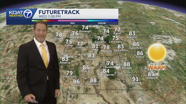
- High pressure is delivering cool, sunny mornings and a steady warmup, with many spots reaching the 70s and 80s and a few inland areas near 90 degrees.
- Northeasterly and other onshore winds are gusting to around 20–25 mph in places, prompting small craft advisories and the potential for localized coastal flooding.
- Overnight chills persist in interior and higher-elevation areas, with frost advisories and even freeze warnings noted in parts of northern New England.
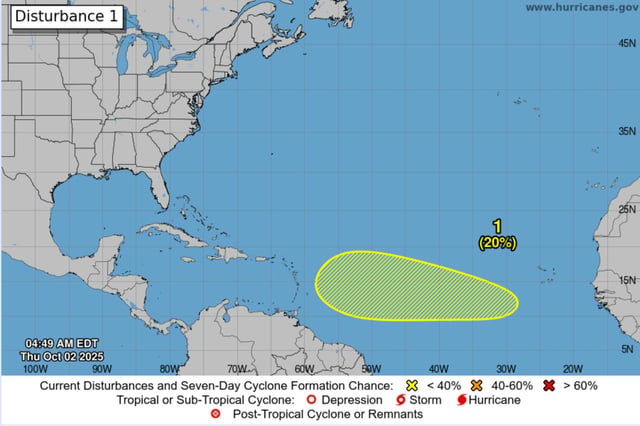
- The Atlantic remains active, with Hurricane Imelda near and moving away from Bermuda and low-probability disturbances being monitored near the Bahamas and in the central Atlantic.
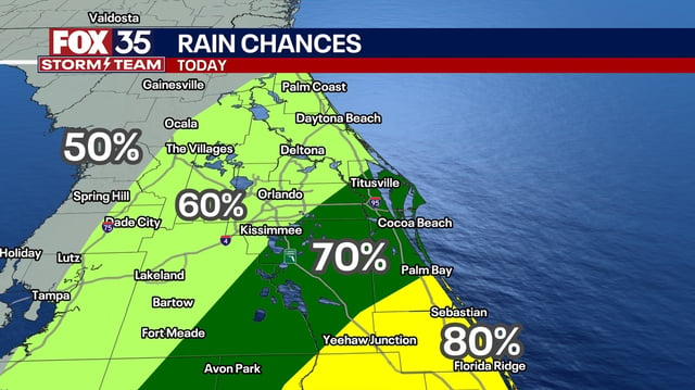
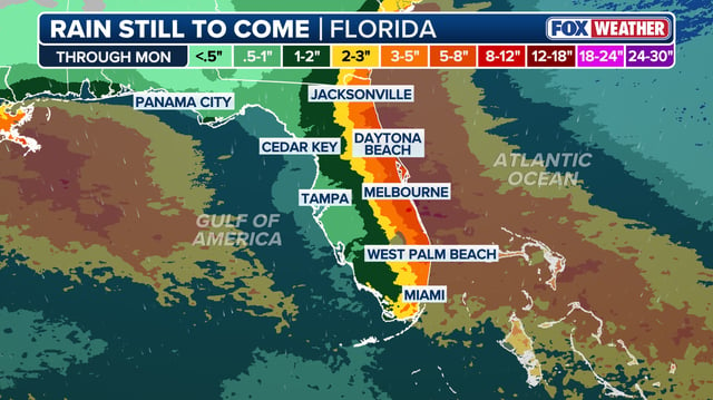
- Forecasts point to a Tuesday–Wednesday cold front bringing scattered showers and a cooldown after the largely dry and warm weekend.