Overview
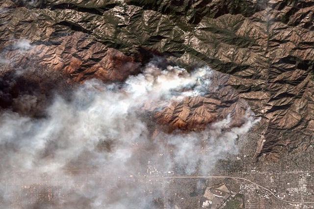
- The project analyzes frequent geostationary satellite imagery, including GOES-R data from NASA and NOAA, to flag smoke plumes.
- Models use machine learning and convolutional neural networks to recognize smoke patterns and generalize beyond trained examples.
- Researchers aim to update detections and locations roughly every 10 minutes, with processing performed at UNAM’s LANOT.
- North America imagery refreshes about every five minutes and global views about every 10 minutes at roughly 0.5–2 km per pixel.
- The team frames early smoke detection as a public-health and environmental tool, noting most forest fires in Mexico are human caused and smoke contributes dangerous PM2.5 and PM10.