

Overview
- Met Office has issued amber and yellow wind warnings for Storm Floris in northern UK with gusts up to 85–90 mph set to peak today and ease by early Tuesday
- WXCharts and MetDesk forecasts predict over 100 continuous hours of 30–34 °C heat from the evening of August 9 through the morning of August 14
- Long-range weather maps signal a potential 37 °C heatwave striking Gloucestershire, Warwickshire, Worcestershire and North Wales around August 16–17
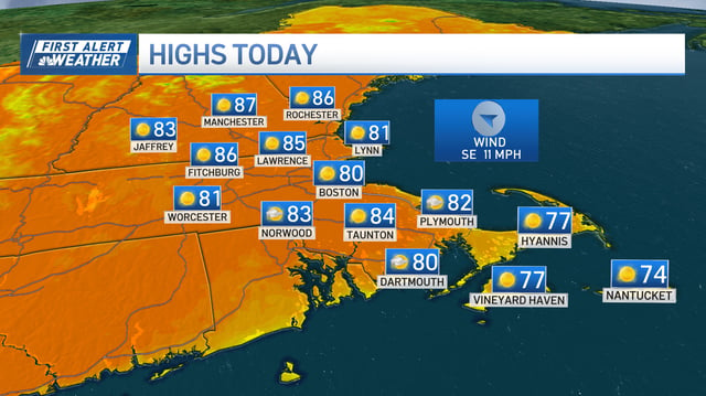
- Air Quality Alerts are in effect across Vermont, New Hampshire and Maine due to Canadian wildfire smoke even as sunny, dry conditions prevail in much of New England
- Other US regions from Baltimore to the San Francisco Bay Area will enjoy stable, mostly sunny weather this week with highs ranging from the 70s to low 90s and occasional breezes