Overview
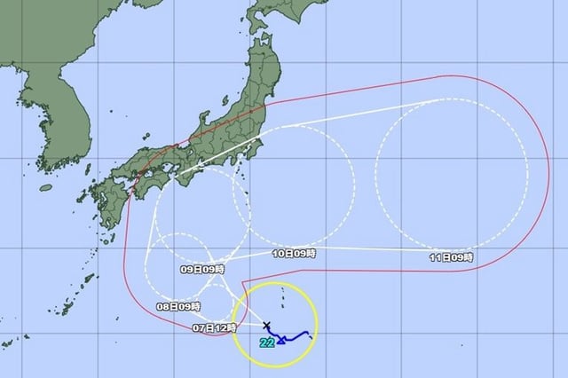
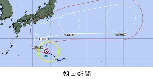
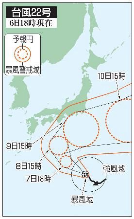
- Japan’s Meteorological Agency says Typhoon No. 22 strengthened to the “very strong” category on Oct. 7 while tracking northwest over waters south of Japan.
- The system is forecast to turn northeast and approach the Izu Islands around Oct. 9 while maintaining strong intensity, with very strong winds and rough seas possible in Kanto.
- JMA guidance around the potential Honshu timeframe indicates central pressure near 955 hPa, sustained winds about 45 m/s, and maximum gusts up to 60 m/s.
- Authorities warn of violent winds, very rough seas, and heavy rain, with risks of landslides, inundation of low-lying areas, and river flooding, especially across the Izu Islands and parts of Kanto.
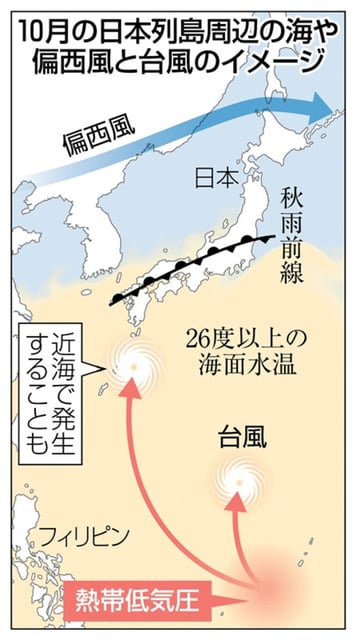
- Winds are expected to strengthen across the Izu Islands from Oct. 8, rainfall may be enhanced by a nearby stationary front, and the exact track remains uncertain so residents should monitor updates.