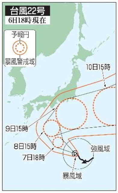
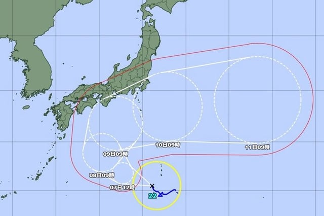
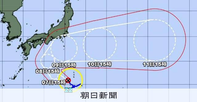
Overview
- As of Oct. 6, the Japan Meteorological Agency placed the center south‑southwest of Chichijima moving northwest with central pressure near 985 hPa and sustained winds around 30 m/s.
- Official forecasts call for intensification to “very strong” by Oct. 9 with central pressure around 955 hPa, sustained winds near 45 m/s, and gusts up to 60 m/s.
- The storm already spans a wide area, with 15 m/s winds extending about 330 km to the east of the center and 220 km to the west.
- From Oct. 8–10, very strong winds and dangerous seas are possible mainly over Pacific waters from western through eastern Japan, according to JMA advisories.
- Forecasters note significant track uncertainty, including a likely northward turn around Oct. 8, and urge close attention to updated guidance.