
Overview
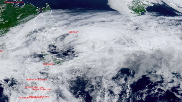
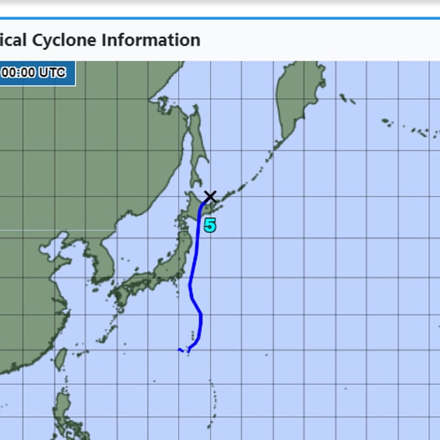
- Typhoon Nari made landfall near Cape Erimo at 02:00 local time on July 15 as the first July storm to hit Hokkaido since records began in 1951
- The system moved into the Sea of Okhotsk and was downgraded to an extratropical storm by 09:00 after tracking northward from Japan’s east coast
- Forecasters expect up to 200 mm of rain in the Kanto-Koshin region, over 80 mm in Tohoku and 120 mm in Hokkaido along with wind gusts exceeding 105 km/h and waves up to 6 m
- Local authorities in Hokkaido and Tohoku have issued evacuation advisories while train and ferry services remain disrupted
- The Japan Meteorological Agency warns that a strong pressure gradient from a nearby high-pressure system could prolong heavy rain, gusty winds and high seas through Wednesday