Overview
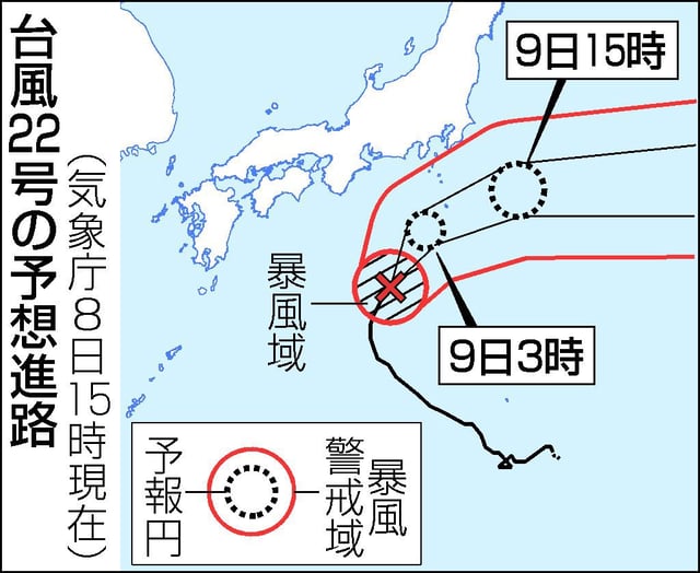
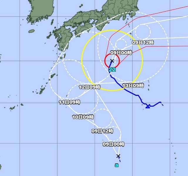
- JMA confirmed at 3 p.m. JST on Oct. 8 that the tropical depression became Typhoon No. 23, Nakri, near 19.0°N, 138.05°E, moving north-northwest about 30 km/h.
- The agency reported central pressure at 1002 hPa with sustained winds of 18 m/s and gusts to 25 m/s, and gale-force winds extending roughly 220 km from the center.
- Forecast guidance keeps the center over waters south of Japan through Oct. 9–11, with a possible approach to Okinawa and southern Kyushu around Oct. 11.
- Okinawa forecasters warn of strengthening winds, rising swell and rough seas, and potential storm-tide flooding in the Daito Islands from Oct. 10–11, especially around high tide.
- JMA expects gradual strengthening to about 23 m/s by Oct. 11 and will issue updated typhoon information every three hours.

