
Overview
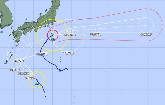
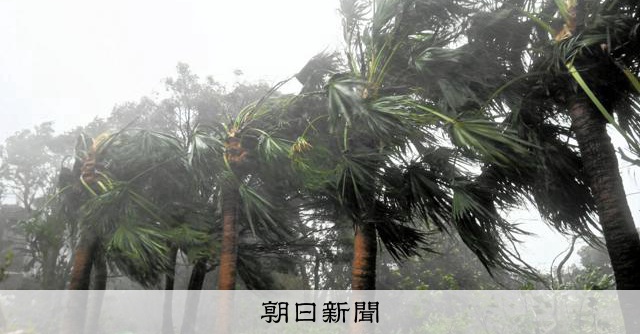
- At around 5–8 a.m. JST on Oct. 9, Typhoon 22 tracked near Aogashima toward the northeast with central pressure near 940 hPa, sustained winds around 50 m/s and peak gusts up to 70 m/s, according to the JMA.
- The JMA issued a heavy rain emergency warning for Hachijo after linear rainbands produced extreme short‑duration downpours, including an estimated 120 mm in one hour before 5:30 a.m.
- Seven Izu municipalities were under special warnings for violent winds and high waves, with Hachijo logging maximum instantaneous gusts reported in the 50.4–54.7 m/s range and seas forecast to 12 meters.
- Kanagawa prefectural authorities reported one death in Oiso after a man in his 60s was swept into the sea by high waves early on Oct. 9.
- Separately, Typhoon 23 is moving northwest south of Japan and is forecast by the JMA to approach the Daito Islands and Okinawa main island on Oct. 10–11, with track details still uncertain.