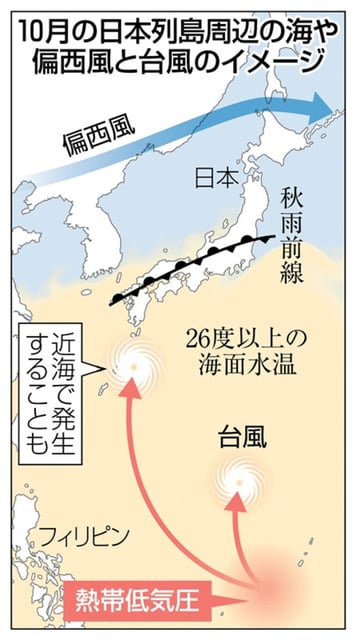

Overview
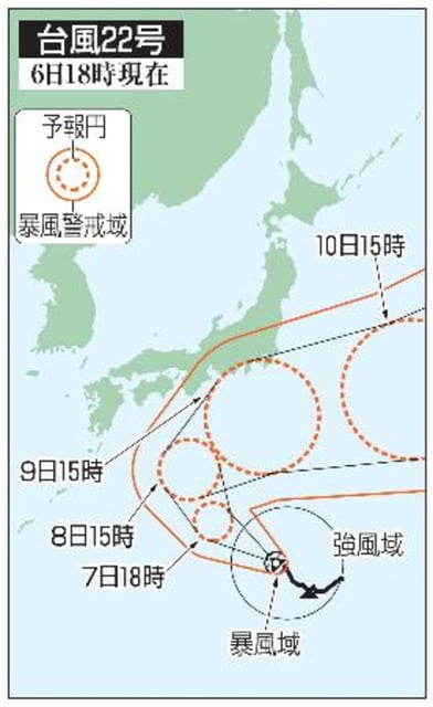
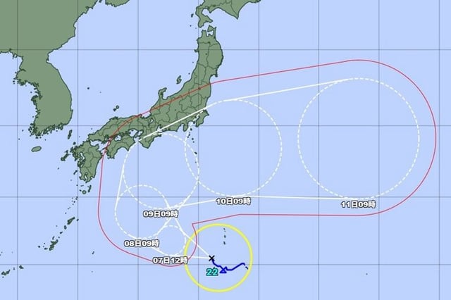
- As of Oct. 6 afternoon, the center was about 190 km southwest of Chichijima, moving northwest near 15 km/h with central pressure 985 hPa, sustained winds 30 m/s and gusts 45 m/s.
- JMA forecasts further intensification, with a potential peak near Oct. 9 around 955 hPa, sustained winds 45 m/s and gusts up to 60 m/s classified as very strong.
- Model guidance indicates a northward turn around Oct. 8 followed by an eastward approach, bringing the system close to the Izu Islands on Oct. 9.
- From Oct. 8–10, very strong winds and dangerous seas are expected mainly over Pacific waters from western to eastern Japan, with additional rain and wind risks depending on the track.
- Forecasters stress significant uncertainty in the exact path and local impacts and urge residents and maritime operators to monitor updates and prepare for high waves and strong winds.