Overview
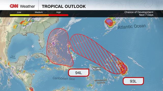
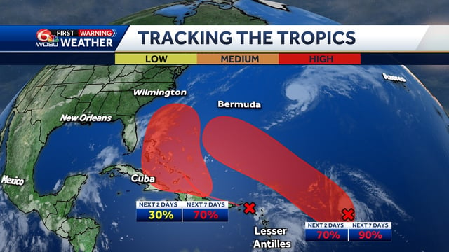
- Invest 93L has a high likelihood of organizing into a depression or named storm within a couple of days and is projected to move northwest, potentially passing near Bermuda early next week.
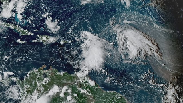
- Invest 94L is producing heavy rain over Puerto Rico and the Virgin Islands through Wednesday, with localized totals up to 6 inches and risks of flash flooding and landslides.
- The National Hurricane Center pegs 94L’s formation chances near 30% in 48 hours and about 70% to 80% over seven days, with development most favored near the Bahamas late this week.
- Forecast models show wide track spread as an Eastern U.S. jet-stream dip could tug the systems, and their proximity raises the possibility of a Fujiwhara-type interaction.
- Potential U.S. impacts remain uncertain, though the Southeast should monitor updates, and forecasters currently expect no immediate effects in southeast Louisiana.