Overview
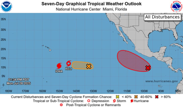
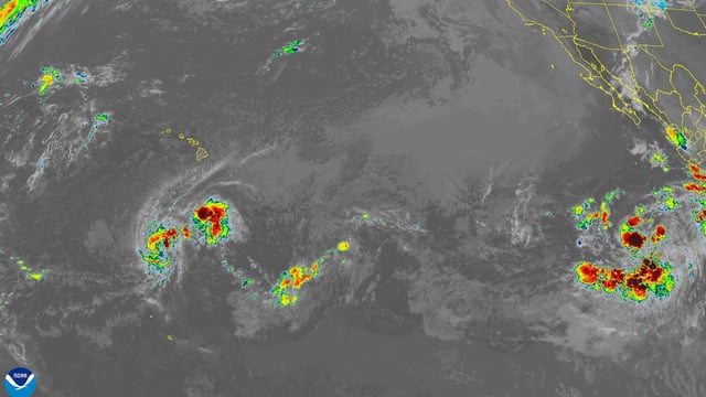
- Hurricane Iona is a Category 3 storm with sustained winds of 125 mph moving west at 13 mph and is forecast to begin steady weakening by Wednesday.
- Tropical Storm Keli has maximum sustained winds of 40 mph and is tracking westward well south of the islands without prompting any coastal watches or warnings.
- The National Weather Service predicts Iona’s circulation will generate subsidence and bring dry, breezy weather across the Hawaiian Islands.
- The National Hurricane Center is monitoring disturbance EP98 about 1,500 miles east-southeast of Hawaii with a 60 percent chance of forming into a tropical cyclone within 48 hours.
- This simultaneous storm activity underscores the central Pacific’s early-season pace under neutral ENSO conditions and reflects the basin’s average of around four cyclones per year.