


Overview
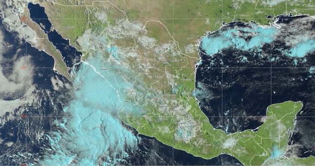
- SMN/Conagua report the former Depression Doce-E off Jalisco has organized into Lorena, with forecasts calling for very strong to intense rains of 75–150 mm in Sonora, Chihuahua, Durango, Sinaloa, Nuevo León, Tamaulipas and San Luis Potosí.
- Outlooks indicate rachas up to 70–90 km/h and surf building to 4.5–6.5 meters on Pacific and Gulf of California coasts, posing high maritime risk later this week.
- Guidance tracks the system toward Baja California Sur and the Gulf of California between Wednesday and Friday, increasing rain and wind across BCS, Sonora, Chihuahua, Durango and Sinaloa.
- Authorities also flag temperature contrasts, with highs above 40–45 °C in parts of Baja California and Sonora and early‑morning lows of 0–5 °C in highlands of Chihuahua, Durango, Estado de México and Puebla.
- In Mexico City, the Metro implemented ‘marcha de seguridad’ on multiple lines due to rain, lengthening intervals, and civil protection urged the public to avoid flood zones, secure property and follow official updates.