Overview
- The National Hurricane Center lists Priscilla as a large storm with tropical-storm-force winds extending about 140 miles from its center.
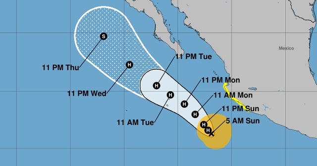
- As of Sunday morning, maximum sustained winds were near 65 mph with the center roughly 295–305 miles south-southwest of Cabo Corrientes, moving north-northwest at about 5 mph.
- Forecasters expect Priscilla to reach hurricane strength by Sunday night while tracking parallel to the southwestern coast and remaining offshore.
- A tropical storm watch is in effect from Punta San Telmo to Punta Mita, with tropical-storm conditions possible Sunday and Monday.
- Rainfall totals of 4 to 6 inches, locally up to 8 inches, are expected in coastal Michoacán and far western Guerrero, with 2 to 4 inches in Colima, western Jalisco, and the rest of coastal Guerrero, and life‑threatening surf and rip currents are forecast to spread north toward west‑central Mexico and the southern Baja California peninsula.