
Overview
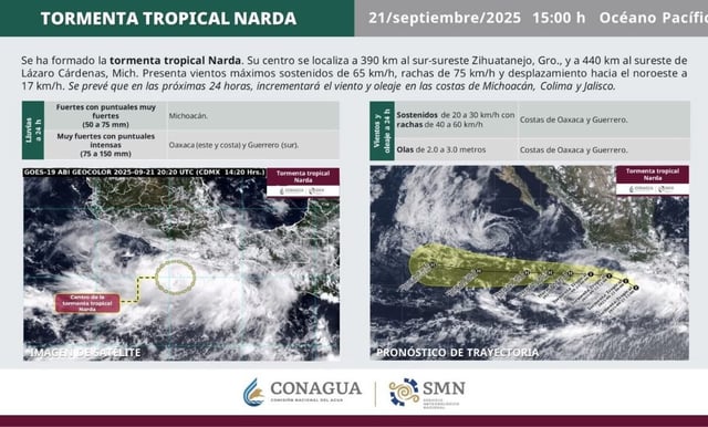
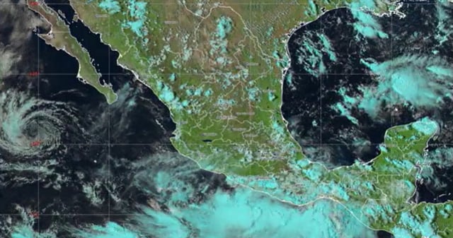
- The storm’s center is about 390 km south-southeast of Zihuatanejo, moving northwest near 17 km/h with sustained winds of 65 km/h, gusts to 75 km/h, and tropical-storm-force winds extending roughly 110 km.
- Forecasters expect intensification over the next 48 hours, with hurricane strength possible by Tuesday if current trends hold and the core remaining offshore for now.
- Heavy rain is projected at 75–150 mm in eastern and coastal Oaxaca and southern Guerrero, with 50–75 mm in Michoacán, raising risks of flash floods and landslides.
- Coastal conditions include wind gusts of 40–60 km/h and 2–3 m seas along Oaxaca and Guerrero, with increasing winds and surf anticipated for Michoacán, Colima and Jalisco.
- Guerrero is under a preventive alert, and authorities urge residents to prepare, identify shelters and evacuation routes, and monitor updates from Conagua, SMN, the NHC and Protección Civil.