Overview
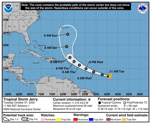
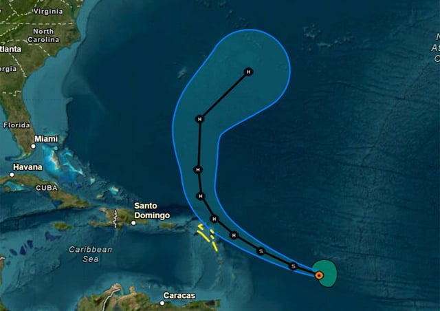
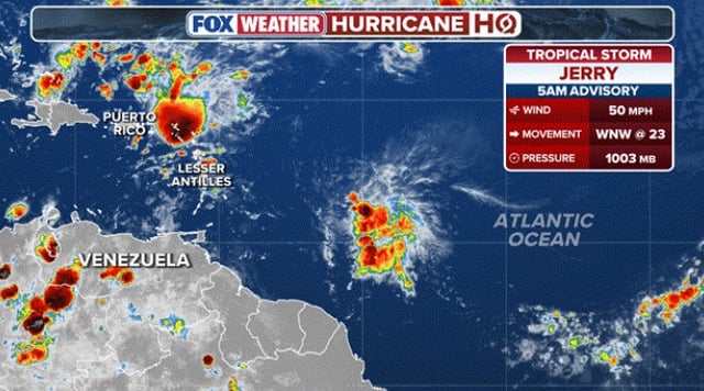
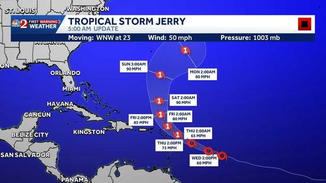
- As of the NHC 5 a.m. advisory, Jerry was about 890 miles east-southeast of the northern Leeward Islands, moving west-northwest at 23 mph with maximum sustained winds near 50 mph.
- Tropical storm watches are in effect for portions of the northern Leeward Islands as the system approaches.
- Jerry is forecast to strengthen to a Category 1 hurricane on Thursday, with its core near or north of the northern Leewards late Thursday into Friday before a turn north.
- Tropical-storm-force winds extend outward up to about 125 miles, with 2–4 inches of rain, gusty winds, and heavy surf expected in the islands and surf reaching the Greater Antilles on Friday.
- A trough in the Bay of Campeche has a 10% chance of development, though heavy rain and gusty winds are likely in southern Mexico later today into early Thursday.