Overview
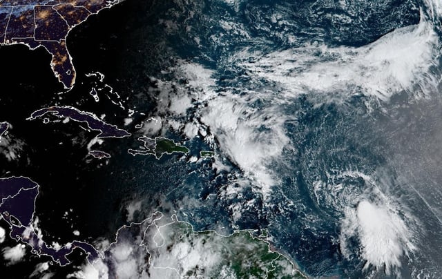
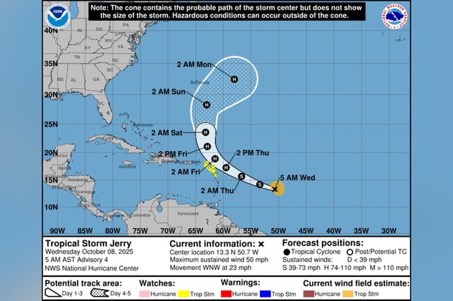
- The National Hurricane Center reported Jerry with sustained winds near 50 mph on Wednesday, moving west-northwest at about 23 mph roughly 835–890 miles east-southeast of the northern Leeward Islands.
- Tropical-storm watches cover parts of the northern Leewards, where 2 to 4 inches of rain, localized flash flooding, and hazardous surf and rip currents are expected Thursday into Friday.
- On the official track, the center passes near or just north of the Leeward Islands late Thursday into Friday before a turn north and then northeast keeps the system offshore of the U.S.
- Model guidance generally keeps the storm east of Bermuda after the weekend, and while intensity outcomes vary, Jerry is forecast to reach Category 1 strength within the next day.
- Separately, a disturbance in the Bay of Campeche has a low (about 10%) chance of development before moving into southern Mexico, where heavy rain and gusty winds are likely.