Overview
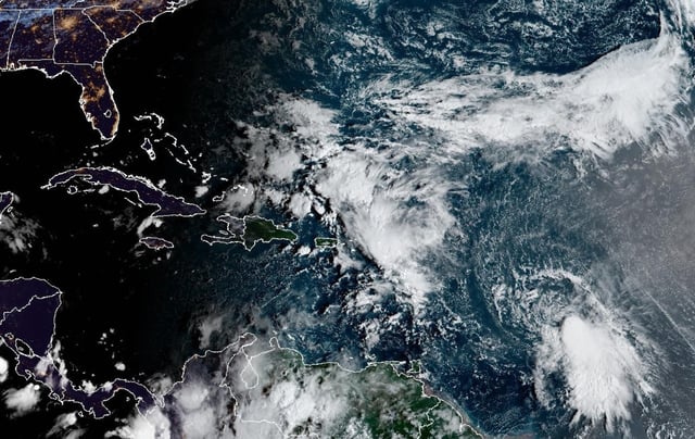
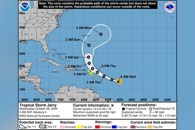
- Tropical Storm Jerry was about 395 miles east-southeast of the northern Leeward Islands early Thursday, moving west-northwest near 20 mph and expected to pass near or just northeast of the islands later today into tonight.
- Tropical-storm watches remain in effect for Antigua, Barbuda, Anguilla, St. Kitts, Nevis, Montserrat, St. Barthelemy, St. Martin, Sint Maarten, Saba, St. Eustatius, Guadeloupe and nearby islands.
- Two to four inches of rain with localized flash flooding, gusty winds and expanding swells are expected across the Leewards, with dangerous surf and rip currents spreading toward the Greater Antilles.
- Despite moderate to strong wind shear slowing rapid intensification, the NHC forecasts gradual strengthening with Jerry reaching hurricane status by late Friday or Saturday, though model guidance still varies on peak strength.
- NHC officials say no direct U.S. impacts are expected, with elevated rip current risk along the East Coast from a separate coastal low and distant Jerry, and Bermuda could be affected depending on the eventual track; NOAA and Air Force Hurricane Hunters are flying the storm to refine forecasts.