Overview
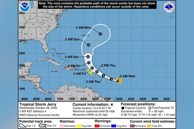
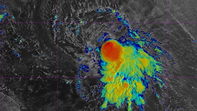
- At the 5 a.m. ET advisory, Jerry had 50 mph winds about 890 miles east-southeast of the northern Leeward Islands and was moving west-northwest at 23 mph, according to the National Hurricane Center.
- Forecast guidance shows a slowdown with a turn to the north by Friday, placing the core near or just north of the northern Leeward Islands late Thursday into Friday.
- Tropical storm watches cover Antigua and Barbuda, Anguilla, St. Kitts and Nevis, Montserrat, St. Barthelemy, St. Martin/Sint Maarten, Saba, St. Eustatius, Guadeloupe and adjacent islands.
- Hazards expected include 2–4 inches of rain, a risk of flash flooding, and life‑threatening surf and rip currents, with tropical‑storm‑force winds extending roughly 125 miles from the center.
- U.S. land impacts are unlikely as steering keeps Jerry offshore, while peak strength remains uncertain in model guidance; the NHC is also tracking a Bay of Campeche disturbance with a 10% formation chance and heavy rain for southern Mexico.