
Overview
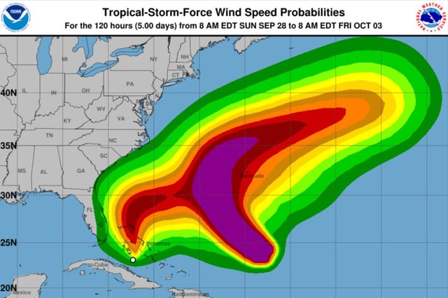
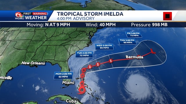
- Tropical Storm Imelda was upgraded Sunday with maximum sustained winds near 40 mph, moving north at roughly 7–9 mph near the central and northwestern Bahamas.
- Tropical storm warnings cover much of the Bahamas, and Florida’s east coast saw watch adjustments with some land-zone watches canceled while marine alerts remain in effect.
- Forecasts call for strengthening to a possible hurricane by late Monday or Tuesday, followed by a turn east-northeast that keeps the center offshore of the southeastern U.S.
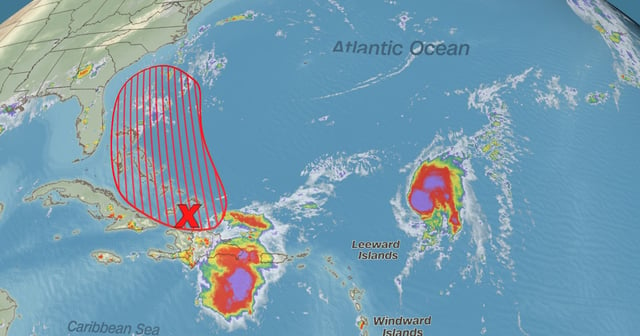
- Imelda is expected to drop 6–12 inches of rain over parts of the Bahamas and raise water levels 1–3 feet in onshore flow, creating flash-flooding and coastal flooding risks; eastern Cuba could see 2–6 inches and isolated mudslides.
- U.S. impacts are expected to be largely coastal—dangerous surf, life‑threatening rip currents, minor coastal flooding, and periods of rain—before conditions gradually improve by midweek.