

Overview
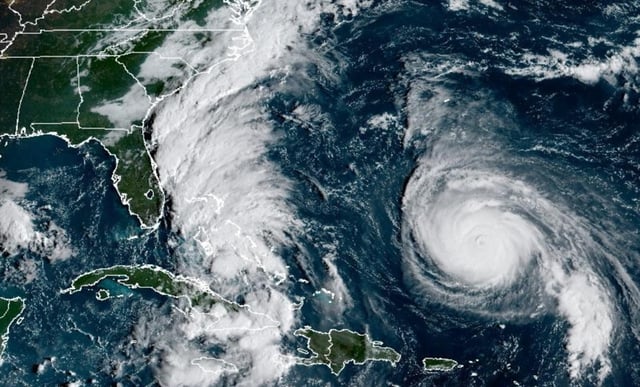
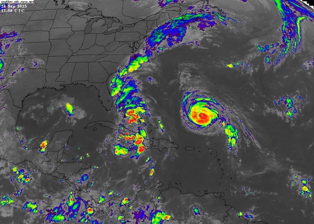
- The National Hurricane Center said Imelda formed Sunday near the central and northwestern Bahamas and is forecast to reach Category 1 strength by Monday or Tuesday while turning east-northeast away from the Southeast U.S.
- Tropical storm warnings are posted for the central and northwestern Bahamas, and a tropical storm watch covers Florida’s east coast from the Palm Beach–Martin county line to the Flagler–Volusia line with impacts beginning Monday.
- Most reliable model ensembles now keep the storm’s center offshore as Hurricane Humberto’s large circulation helps pull Imelda out to sea, though forecasters note some uncertainty remains.
- Hazards include dangerous surf, rip currents, beach erosion, coastal flooding and periods of heavy rain with gusty winds; rainfall totals have trended lower, with roughly 1–5 inches possible in parts of the coastal Carolinas through midweek and locally higher amounts if the system slows.
- South Carolina and North Carolina have mobilized resources and issued emergency measures, and Bermuda is preparing for Humberto to pass to its west Tuesday into Wednesday with swells reaching much of the U.S. East Coast.