Overview
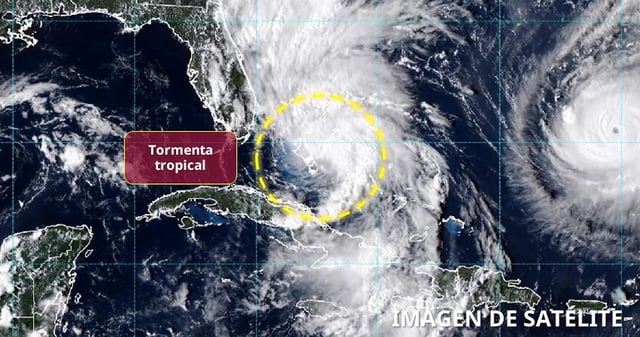
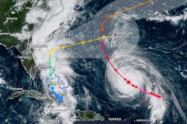
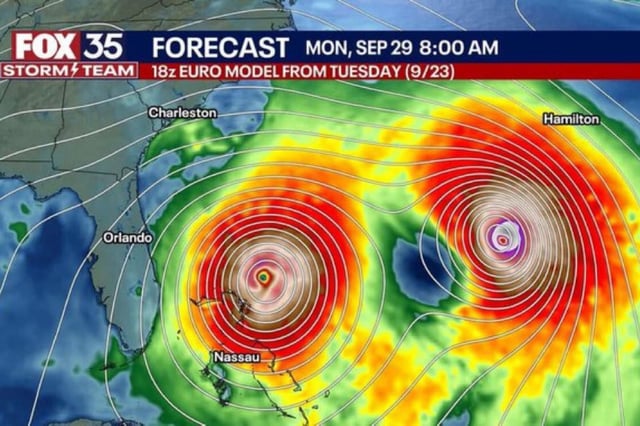
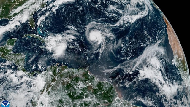
- Imelda organized Sunday with sustained winds near 75 km/h and early Monday was about 475 km southeast of Cape Canaveral, moving north before a forecast turn east-northeast that keeps its center offshore while it strengthens to a hurricane.
- Parts of the Bahamas remain under tropical-storm warnings with 10–20 cm of rain and 30–90 cm of coastal inundation possible, while eastern Cuba could see an additional 5–10 cm of rainfall.
- The Florida Atlantic coast tropical-storm advisory was canceled Sunday night, yet forecasters still expect dangerous surf, rip currents and pockets of coastal flooding from Florida to the Carolinas, with 5–15 cm of rain possible along the Carolina coasts through Tuesday.
- Hurricane Humberto is a powerful Category 4 south of Bermuda, which is under a tropical-storm warning, and its large swell field will send large, hazardous waves to much of the U.S. East Coast as the storm passes west then north of Bermuda Tuesday into Wednesday.
- South Carolina’s governor urged residents to stay alert, North Carolina declared an emergency and FEMA said it is ready to support, as forecasters note decreasing wind risk for the Southeast but continuing uncertainty on exact impacts.