
Overview
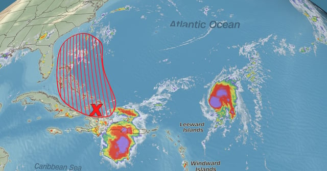
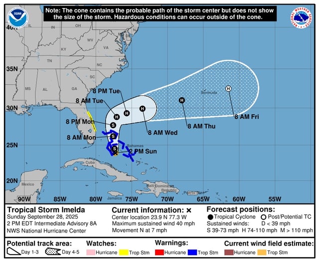
- Air Force data puts Imelda near 23.9°N, 77.3°W with 40 mph winds, moving north at 7 mph and forecast to strengthen, possibly reaching hurricane intensity by late Monday or Tuesday.
- A tropical storm warning is in effect for the central Bahamas, and a tropical storm watch covers Florida’s east coast from the Palm Beach/Martin County line to the Flagler/Volusia County line.
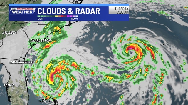
- The National Hurricane Center says most reliable ensembles now keep the center offshore, yet it warns of heavy rainfall from coastal Georgia through the Carolinas into the southern Mid-Atlantic.
- Rainfall projections include 6–12 inches in the northwest Bahamas, 2–6 inches in eastern Cuba, 2–4 inches with local 7-inch maxima in the coastal Carolinas, and 2–5 inches in parts of coastal and south Florida through Monday.
- Coastal hazards include life-threatening surf and rip currents from Imelda and Hurricane Humberto, minor flooding potential along parts of the Southeast U.S. coast, and a 1–2 foot surge possible from the Volusia/Brevard line to South Santee River if onshore winds persist.