Overview
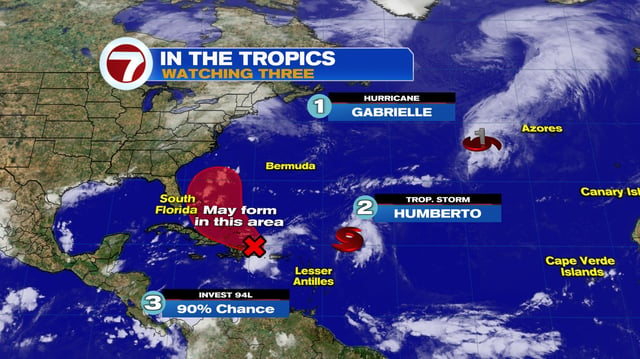
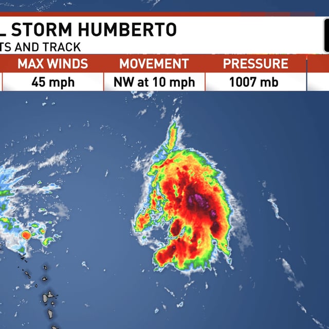
- The National Hurricane Center reports Humberto at about 45 mph, several hundred miles east-northeast of the northern Leeward Islands, moving northwest near 10–12 mph with a forecast to reach hurricane strength this weekend and possibly major status early next week.
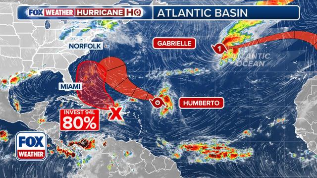
- A tropical wave designated Invest 94L near Puerto Rico and the Dominican Republic carries a 50% chance of formation in 48 hours and 80% in seven days, with development most likely near the Bahamas late this week after producing heavy rain over the northeastern Caribbean.
- No coastal watches or warnings are in effect for Humberto, but forecasters caution that large swells and rip currents could reach parts of the U.S. East Coast even if the system remains offshore.
- Model guidance shows wide spread on Humberto’s future path and on how strong 94L becomes, with forecasters noting possible—but not guaranteed—interaction between the two systems that could alter their tracks.
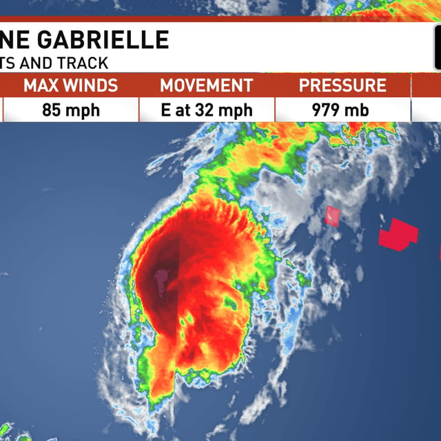
- Separately, Hurricane Gabrielle is under a Hurricane Warning for the Azores and is expected to cross the islands at hurricane strength, with swells continuing to affect Bermuda, the U.S. East Coast from North Carolina northward, and Atlantic Canada.