Overview
- The National Hurricane Center confirmed Tropical Storm Humberto with 40 mph winds about 550 miles east-northeast of the Leeward Islands, moving west-northwest and expected to strengthen through the weekend.
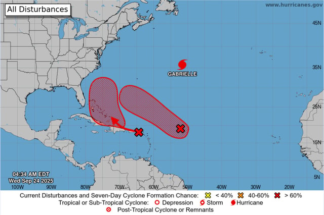
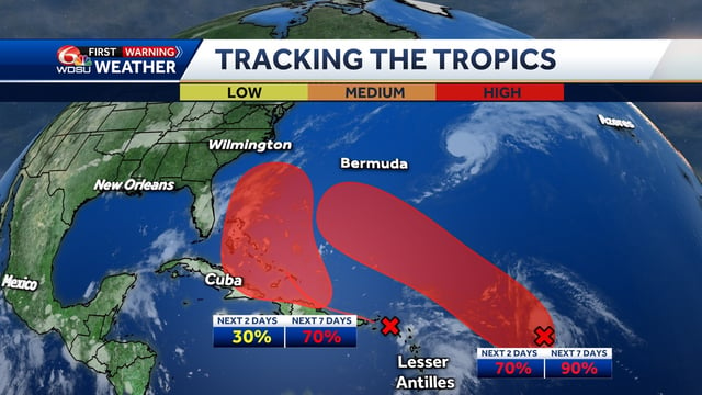
- Invest 93L, located well east of the Leeward Islands, has an 80% two-day and 90% seven-day formation chance and is forecast to pass north of the Caribbean with many model tracks near Bermuda.
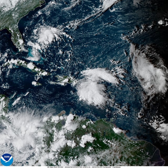
- Invest 94L is producing heavy rain and gusty winds across the northeastern Caribbean, with 30% two-day and 80% seven-day odds to develop as it nears the Bahamas late week into the weekend.
- Model guidance remains divergent, and the proximity of Humberto and 94L raises the possibility of Fujiwhara interaction, so a track closer to the Southeast U.S. cannot yet be ruled out.
- Hurricane Gabrielle remains a Category 3 targeting the Azores under hurricane warnings, with swells generating dangerous surf and rip currents for Bermuda, the U.S. East Coast and Atlantic Canada.