

Overview
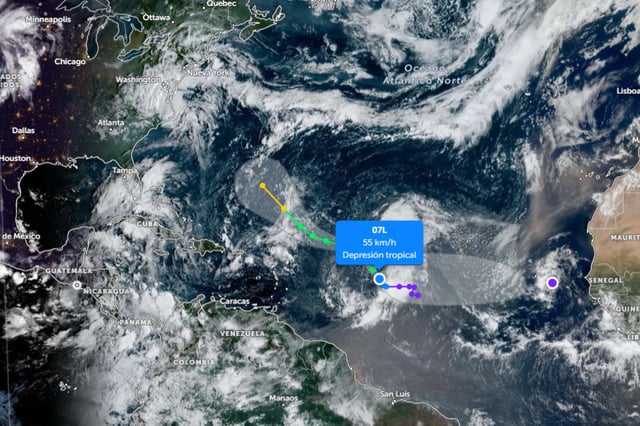
- Gabrielle formed in the central Atlantic after nearly three weeks without a named storm during the seasonal peak, a rarity recorded only once before since 1950.
- The National Hurricane Center expects gradual intensification, with Gabrielle likely reaching hurricane strength this weekend while tracking west‑northwest before curving into the central Atlantic.
- Near‑term impacts are limited to hazardous seas and rip currents for parts of the northeast Caribbean, with no land warnings in effect and no expected effects for Mexico due to distance and current track.
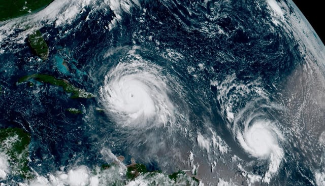
- Mexico’s weather agencies are monitoring a Pacific low with a high chance of becoming Cyclone Narda and have issued widespread alerts for heavy rain, flooding, strong winds and elevated surf across numerous states.
- Despite warm sea‑surface temperatures and an above‑normal seasonal outlook, stronger wind shear and dry, stable air helped suppress storms in recent weeks, leaving the basin with fewer named systems so far this season.