
Overview
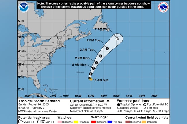
- As of Saturday evening, Fernand was about 405 miles south-southeast of Bermuda with maximum sustained winds near 40 mph and moving generally north to north-northeast.
- National Hurricane Center guidance projects a north-northeast track that takes the center well east of Bermuda and across the open subtropical North Atlantic.
- Forecasters expect some strengthening over the next 48 hours, with Fernand possibly approaching hurricane intensity on Monday before weakening begins Tuesday.
- No U.S. coastal watches or warnings are in effect, and while direct impacts to the mainland are not expected, rough surf and rip-current hazards are a concern for Atlantic beaches and Bermuda should monitor for gusty winds and dangerous seas early in the week.
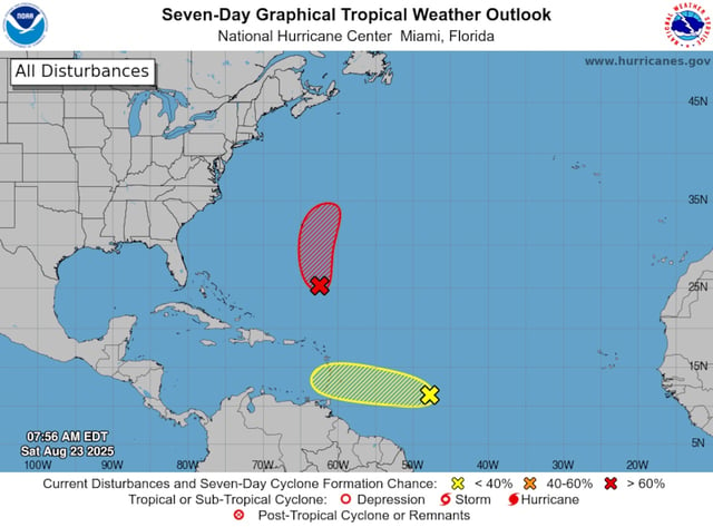
- A separate tropical wave about 850 miles east of the Windward Islands has a low chance of development, with locally heavy rain and gusty winds possible as it moves west through early week.