


Overview
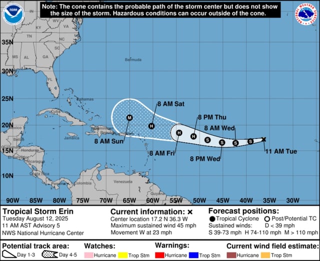
- The National Hurricane Center reported Erin had sustained winds of 45 mph and was moving west at about 22–23 mph in the central Atlantic as of August 12.
- Forecast models project the storm will reach hurricane strength by Thursday, August 14, and major hurricane status by Sunday, August 17.
- Most forecast models still show Erin recurving northeast away from the United States, but some ensemble runs have shifted southward, raising risks to the northern Leeward Islands, the U.S. Virgin Islands and Puerto Rico.
- Even if Erin remains offshore, it is expected to generate dangerous surf and rip currents along the East Coast from the Carolinas to Maine.
- A separate surface trough near Louisiana is producing heavy rain and localized flooding but is not expected to develop into a tropical cyclone.